This time last week my friend Kathleen and I were in Grand Marais, a town on Minnesota's North Shore of Lake Superior. It's a beautiful area of the state, and one which I had not visited since 2004.
The area is renowned for its alternating rocky cliffs and cobblestone beaches, with forested hills and ridges through which rivers and waterfalls descend as they flow to Lake Superior.
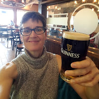
Above: With Judy, a friend of both Kathleen and I. Judy lives in the woods outside of the town of Finlayson, MN. We stayed with her on Thursday night, June 15, on our way to the North Shore. We greatly enjoyed and appreciated Judy's hospitality. Thanks, Judy!
About the history of the North Shore's indigenous populations, Wikipedia notes the following:
Lake Superior was settled by Native Americans about 8000 BCE when the Wisconsin Glaciers began to retreat. By 500 BCE the Laurel people had established settlements in the area and had begun to trade metal with other native peoples. The Laurel people were animists and probably created many of the pictographs present on rock faces along the North Shore and other Canadian rock faces in order to communicate with spirits.
In the 12th century, on the easternmost portion of the North Shore, the ancestors of the Ojibwa migrated into the area. These people left behind small pits dug in the ground which archaeologists now call Pukaskwa Pits. On the Minnesotan portion of the North Shore there are only three archaeological sites, so it cannot be determined who lived there at the time.
By the 18th century the Ojibwa had settled the length of the North Shore approximately as far as the modern Canadian–Minnesotan Border. The Minnesota portion of the North Shore was settled mostly by the Cree, while the Dakota lived to the south.
Whenever I visit an area I try to support the local artist community, and Grand Marais is quite the art colony. Accordingly, when in Grand Marais last weekend, I purchased a print of Howard Sivertson's artwork entitled "Solitude" (right).
Raised as a third generation commercial fisherman in Washington Harbor on Isle Royale, Sivertson works primarily in watercolor and oils either on location or in his Grand Marais studio. He is well known for painting the scenes and historical events of the North Shore, Isle Royale, and the Boundary Waters Canoe Area Wilderness. His artwork, combined with text, features in a number of books focusing on the area's history. These books include Once Upon an Isles (1992), The Illustrated Voyageur (1994), Tales of the Old North Shore (1996), Schooners, Skiffs & Steamships: Stories Along Lake Superior Water Trails, and Driftwood: Stories Picked Up Along the Shore (2008).
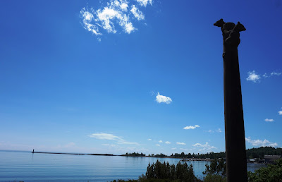
Above: Grand Marais Harbor – Friday, June 16, 2017.
Grand Marais, population approx. 1,400, is French for "Great Marsh," a reference to a marsh that, in early fur-trading times, was situated at the head of the town's harbor. The Ojibwe name for the area is Gichi-biitoobiig, which means "great duplicate water," "parallel body of water" or "double body of water" (like a bayou), a reference to the two bays which form the large harbor off Lake Superior.
Some more interesting details about Grand Marais, courtesy of Wikipedia:
The land surrounding Grand Marais slopes up to form the Sawtooth Bluff, a dramatic rock face visible from nearly any vantage point in the city. Adjacent to the bluff is Pincushion Mountain, a large bald monolith with dramatic views of Lake Superior and the inland wilderness.
Grand Marais Harbor is protected by Artist's Point, a barrier island formed by lava that was connected to the mainland by gravel deposited by lake currents, forming a tombolo. An Arctic–alpine disjunct community survives there.
Road access to Grand Marais is by Minnesota Highway 61, which heads northeast, following the shore of Lake Superior, and is known as the North Shore Scenic Drive. The Gunflint Trail (Cook County Road 12) begins in Grand Marais and heads northwest, away from the lake and into the Boundary Waters region.
Grand Marais is located 110 miles northeast of Duluth and 40 miles southwest of the Canada–US border.
Above: Grand Marais Harbor – Friday, June 16, 2017.
Above: The Shoreline Inn, our lodgings in Grand Marais.
Above and below: Views of Grand Marais – June 16-17, 2017.
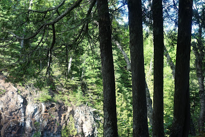
Above and below: Kathleen and I at Cascade Falls State Park – Friday, June 16, 2017.
See also the previous Wild Reed posts:
• Days of Summer on the Bayfield Peninsula (2013)
• Sunday in Duluth (2010)
• Trempealeau (2009)
• Northwoods (2008)
Related Off-site Links:
Walking the Old Road: The Story of Chippewa City and the Grand Marais Chippewa – PRX.org (2010-2011).
Anishinaabe Way: Lives, Words and Stories of Ojibwe People – WTIP.org.
The Sivertson Gallery: Art of the North.
Things to Do On the North Shore, Mile by Mile – North Shore Visitor (2017).


1 comment:
nice traits of your life in US... from these ones and the others from the US and from Australia, my thoughts are: I envy the Anglophone world... this world saved Europe during WW2 , including my country , Italy, form Nazism and fascism.... and afterwards also , from Soviet communism....
while I was a child in the Sixties our father used to tell us that the US were "20 years ahead of us Italians" in terms of everything...
However, since the mid Nineties my country declined dramatically (Berlusconi's three governments and other events) and now the gap is bigger....
its is a pity, because it is my country, and, also, because the Italians have some good psychological and intellectual talents, which, sadly, are spoiled by some bad cultural ideologies and moral habits of ours...
Post a Comment